


From the Reiteralm to famous Mirror Lake
Accessible by public transport- Hiking bus (within 15 minutes walking distance from starting point)
Characteristics
FitnessThe tour in numbers
Level of difficulty
easy
Route
4,0 km
Time
1:30 h
Uphill
150 hm
Downhill
150 hm
Highest point
1880 m
Easy, short hike at elevations between 1700 and 1900 m, on a good trail to two very photogenic mountain lakes with splendid views of the Dachstein.
This hiking tip is a leisurely, short mountain hike to a beautiful destination – the "Spiegelsee", meaning Mirror Lake. Its original name is actually Mittlerer Gasslsee, but over the last 30 years, many photo-loving hikers have re-christened it.
In a wonderful setting, whenever winds are calm it serves up the most beautiful reflections imaginable. If you stand on the south shore, you are treated to an amazing reflection of the south face of the Dachstein Massif! The colors are spectacular from mid June on, when the rhododendron come into full bloom (Rhododendron Festival), delightful summer scenery in July and August, while the golden-yellow larches of October bring us magnificent contrasts. We are but a short climb from the Obersee, a small Ice-Age tarn, picturesquely and peacefully nestled in the rearmost cirque at the foot of the Rippetegg and Pichler Schober. Magnificent panoramic views of the Dachstein and Bischofsmütze.
Best season
January
February
March
April
May
June
July
August
September
October
November
December
More information
Approximately 4 km West of Schladming take exit Pichl from highway B320 Ennstalbundesstraße and continue on Preuneggstraße road towards Reiteralm. Taking a couple of switchbacks you reach the valley terminal of Preunegg-Jet gondola which operates also in summer (operating times at www.reiteralm.at).
You can also continue on Reiteralmstraße road (toll road) to Eiskarhütte, Reiteralmhütte or Gasselhöh'-Hütte huts.
Parking is available at the valley terminal of Preunegg Jet gondola as well as at the huts of Eiskarhütte, Reiteralmhütte or Gasselhöh'-Hütte.
From the mountain terminal (or the car parking at Gasselhöh'-Hütte Inn respectively) follow trail n° 66 around Reiteralmsee Lake and follow the signage and trail n° 66 into the forest towards Spiegelsee Lake. The easy hiking trail runs along the East slopes of the ridge between Rippetegg and Gasselhöhe summits.
After approximately 45 minutes you reach the picturesque "Mirror Lake". A couple of minutes more and you reach the small Obersee Lake between the summits of Rippetegg and Schober.
Alternatives for the way back:
- Another possible way back is via the Reiteralm High Trail (via Rippetegg and Gasselhöhe summits) with an additional 2 hours
- On the way back you can also make a smaller detour via trail n° 66a and Untersee Lake (an additional 30 minutes).
Changes in weather patterns, quick falls in temperature, thunderstorms, wind, fog and snow are some of the dangers that can be encountered on a hiking tour. Hosts of alpine huts and mountain refuges have a lot of experience in the mountains and can give good advice about weather and the trails. Poor equipment, overestimation of one's own capabilities, carelessness, poor personal constitution and/or wrong judgement can lead to critical situations. In case of thunderstorms: avoid summits, ridges and steel ropes.
GPS data and orienteering
Available GPS data - just like hiking maps - is only a guidance for orientation and can never depict a trail exactly with all its details. Especially at dangerous spots it is essential to judge on site how to proceed.
In an emergency please call:
- 140 - for Alpine emergencies (all over Austria)
- 112 - European GSM emergency number
On the way back make a small detour via trail n° 66a and Untersee Lake.
Ramsauer Verkehrsbetriebe offers a bus connection to the valley terminal of Preunegg-Jet gondola on Tuesday, Friday and Sunday.
- Buses of Ramsauer Verkehrsbetriebe: www.rvb.at
From there you take the cable car Preunegg-Jet to Reiteralm.
Tourist information: www.schladming.com
Information about bus schedules: www.rvb.at
Information about cable-car hours: www.reiteralm.at
- Hiking map ‘Hiking WEST’ available at the information offices in the region.
- Schladming hiking map, 1:25,000, available at the Schladming information office.
- Hiking map Schladming-Dachstein, 1:50,000, available at the information offices in the region.
- Hiking guide Schladming-Dachstein by Herbert Raffalt, available at the information offices in the region.
Map & downloads
Gallery

Der Spiegelsee (Mittlerer Gasselsee) auf der Reiteralm | © Herbert Raffalt | Schladming Dachstein
1/3
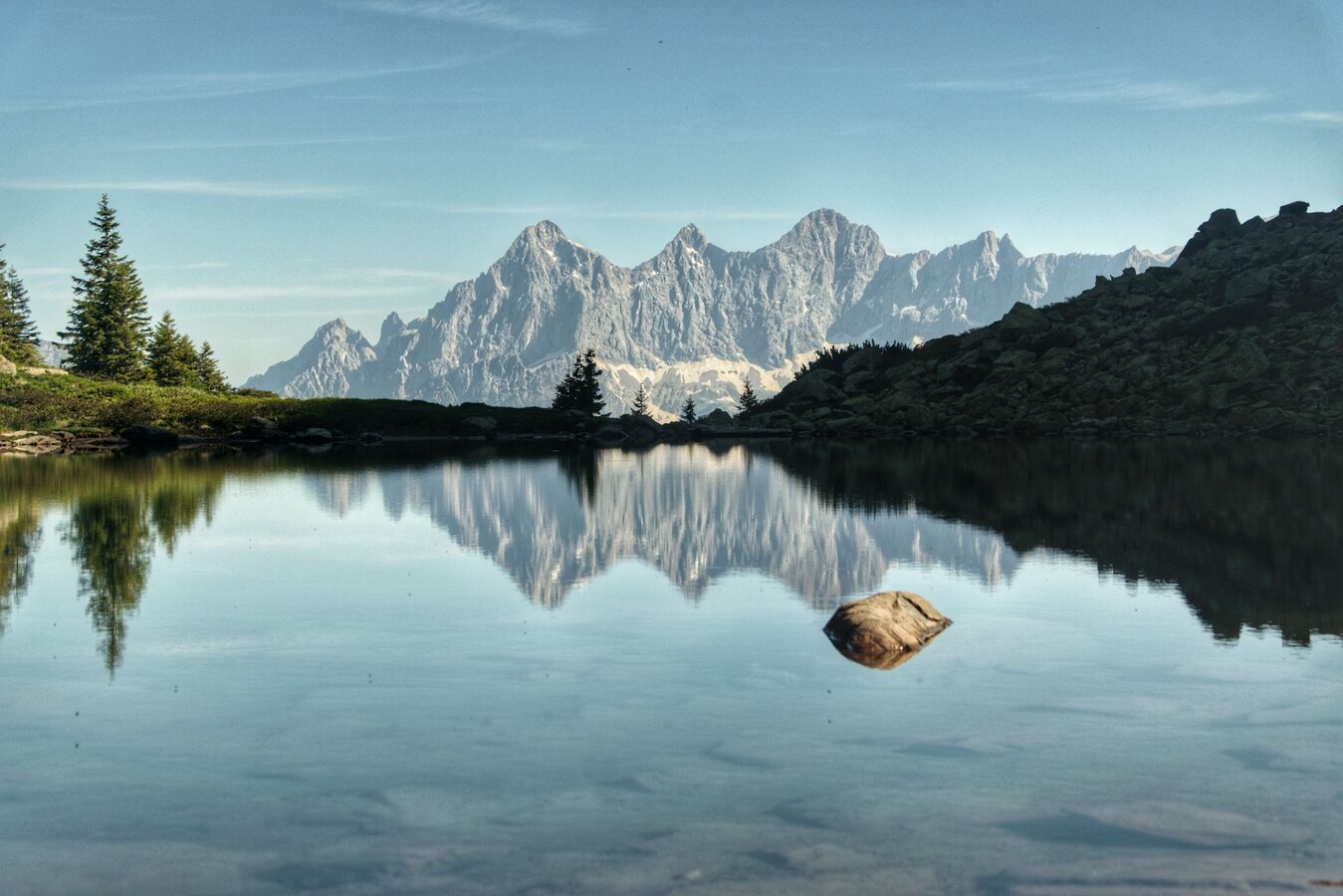
Spiegelsee on the Reiteralm | © Erlebnisregion Schladming-Dachstein | Marlene Eggmayr
2/3
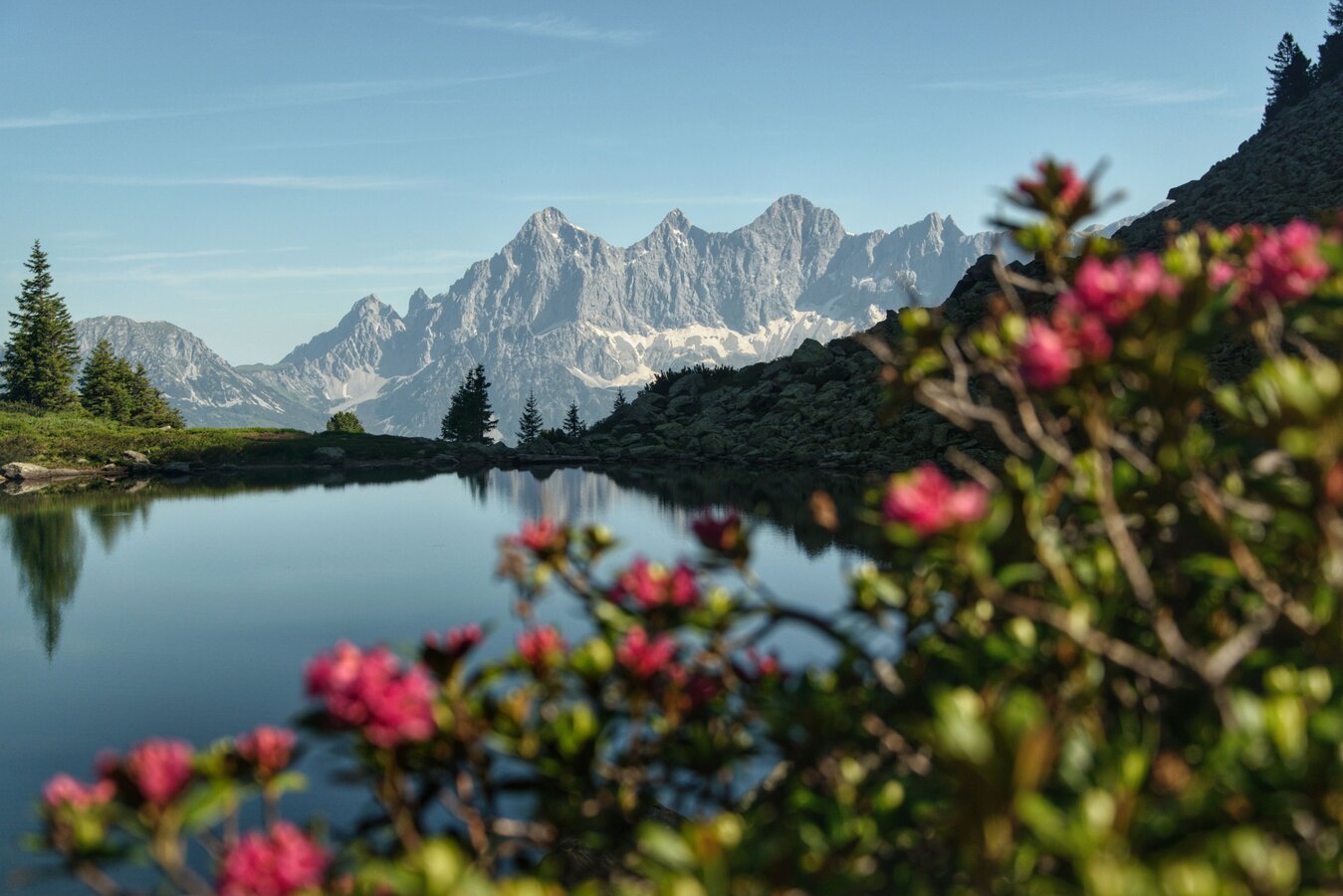
Spiegelsee with Dachstein view | © Erlebnisregion Schladming-Dachstein | Marlene Eggmayr
3/3

What the weather will be like Schladming (740m)
Today, 24.10.2026
Rainfall will end around noon, then the clouds will break up.Morning

3°C
sr.Regenwahrscheinlichkeit
75%
sr.Windstärke
5 km/h
Noon

7°C
sr.Regenwahrscheinlichkeit
80%
sr.Windstärke
5 km/h
Night

3°C
sr.Regenwahrscheinlichkeit
45%
sr.Windstärke
5 km/h
Tomorrow, 25.10.2026
Mostly cloudy through the day with light rain now and then.Morning

-1°C
sr.Regenwahrscheinlichkeit
20%
sr.Windstärke
0 km/h
Noon
8°C
sr.Regenwahrscheinlichkeit
50%
sr.Windstärke
5 km/h
Night
6°C
sr.Regenwahrscheinlichkeit
80%
sr.Windstärke
5 km/h
Forecast
26.10.2026
0°C
11°C
27.10.2026
-1°C
13°C
28.10.2026
2°C
12°C
