


Stage 06 From Glacier to Wine South Route Gollinghütte - Preintalerhütte
Characteristics
SkillThe tour in numbers
Level of difficulty
challenging
Route
8,4 km
Time
6:00 h
Uphill
1009 hm
Downhill
986 hm
Highest point
2614 m
This stage of the Hiking Trail From Glacier to Wine leads to one of the most spectacular and impressive landscapes in the Alpine mountain world: the Klafferkessel in the heart of the Schladminger Tauern. Characterised by rugged peaks, high-alpine terrain, and a remarkable concentration of mountain lakes, this section is among the scenic highlights of the entire route. The terrain becomes more demanding in places, particularly in the area around the Greifenberg, where sure-footedness and a head for heights are essential. Those who tackle this stage are rewarded with unforgettable panoramas and a unique wilderness experience in one of the most beautiful mountain regions of Steiermark.
The Klafferkessel is one of the most remarkable high-alpine landscapes in the Schladminger Tauern. Situated within the Natura 2000 Schladminger Tauern Protected Area, this former glacial basin is home to around 30 mountain lakes, creating a unique landscape of water, rock, and ice.
The Klafferkessel consists of two interconnected cirques containing a remarkable concentration of lakes of varying sizes, many of which remain partially frozen well into the summer months. Among the largest are the Lower Klaffer Lake (Unterer Klaffersee), the Rauhenbergsee, and the Upper Klaffer Lake (Oberer Klaffersee).
The combination of crystal-clear lakes, extensive boulder fields, and sparse vegetation creates an almost otherworldly atmosphere. Mosses and lichens thrive in this harsh environment and, together with the rugged rock formations and lingering snowfields, give the landscape the appearance of a remote northern tundra. The result is a striking wilderness scenery that offers hikers a glimpse into the powerful forces that shaped the Alps during the last Ice Age.
Best season
January
February
March
April
May
June
July
August
September
October
November
December
More information
Detailed information on how to get to can be found here.
The Gollinghütte is not directly accessible by car or public transport, for more information please contact the Gollinghütte directly.
From the Gollinghütte (Tel. +43 676 5336288), this stage of the Hiking Trail From Glacier to Wine begins with a sustained ascent. The trail climbs in numerous switchbacks over rocky steps and mountain slopes, passing a small mountain lake on the left before reaching the Greifenbergsattel. Depending on the time of year, the final metres below the saddle may still be covered with snow, as the slope often retains snowfields well into the hiking season.
After the long climb, hikers are rewarded with a breathtaking panorama that is likely to remain etched in memory for years to come. From the Greifenbergsattel, one of the finest viewpoints in the Schladminger Tauern, an extraordinary view opens across the Klafferkessel with its countless lakes and tarns.
Dominating the landscape are the dark-green, deeply sculpted slopes of the Waldhorn, which form a dramatic backdrop to the glacial basin. Below, the numerous lakes shimmer amidst carpets of moss and alpine vegetation, spread across different levels of the terrain. Further east rises the summit of the Hochwildstelle, while beneath it the striking green slopes of the Himmelreich create a beautiful contrast to the rugged mountain scenery.
The route then continues steeply downhill towards the Obere Klafferscharte. The descent follows an alpine path with a series of steep switchbacks, with the uppermost section secured by fixed ropes. Once in the basin of the Klafferkessel, the trail traverses a remarkable landscape of moss-covered ground, crystal-clear lakes, and glacial formations before reaching the Untere Klafferscharte.
Passing the Unterer Klaffersee, the route descends over a short section of scree and gravel into the alpine landscape of the Lämmerkar. After crossing the Waldhornbach stream, we continue on the Central Alpine Trail 02, following increasingly gentle meadow paths down towards the Preintalerhütte (Tel. +43 664 1448881) and the Waldhornalm (Tel. +43 3687 61475).
Tip: As this stage traverses high-alpine terrain, it is well worth asking the hut hosts for the latest weather forecast and trail conditions before setting out on the next stage towards the Putzentalalm.
Emergency call mountain rescue: 140
Tips when reporting an emergency – Answer these six WH questions: What happened? How many people are injured? Where did the accident happen (are there GPS coordinates)? Who is reporting the incident (callback number)? When did the accident happen? What is the weather like at the site of the incident?
Proper backpack packing makes many things easier: Pack heavy things first. The water bottle should always be within reach in a side pocket. All the things that are often needed, such as sunglasses, camera or hiking map, belong on top. An emergency kit, including blister plasters, belongs in every rucksack and it is always advisable to dress in layers.Detailed information about arriving by ÖBB (Austrian Federal
Railways) can be found at www.oebb.at or
on the Verbundlinie Steiermark website www.busbahnbim.at
With
Verbundlinie’s BusBahnBim route planner app, planning your journey
has never been easier: simply enter towns and/or addresses, stop names or
points of interest to check all bus, train and tram connections in Austria. The
app is available free of charge for smartphones – on Google Play and in the App
Store
Steiermark Tourismus, Tel. +43 316 4003
www.steiermark.com
Kompass WK293 Dachsteingruppe, Schladminger Tauern www.kompass.at
Freytag & Berndt WK 201 Schladminger Tauern · Radstadt · Dachstein www.freytagberndt.at
Map & downloads
Gallery
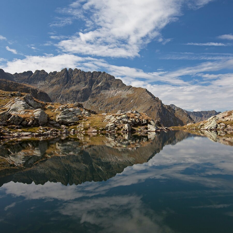
Die Klafferkessel | © Steiermark Tourismus | Herbert Raffalt
1/8

Wanderroute "Vom Gletscher zum Wein" | Weitwanderweg Steiermark | © Steiermark - Das Grüne Herz
2/8
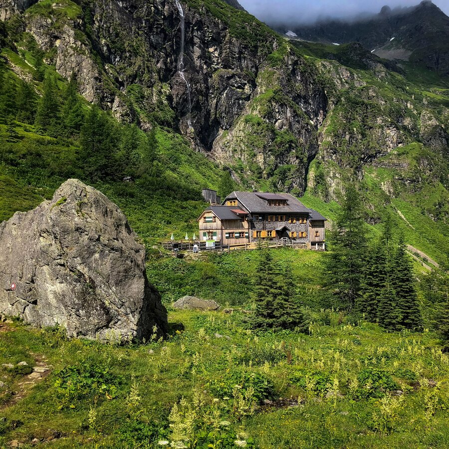
Blick auf die Gollinghütte | © Steiermark Tourismus | Martina Traisch
3/8
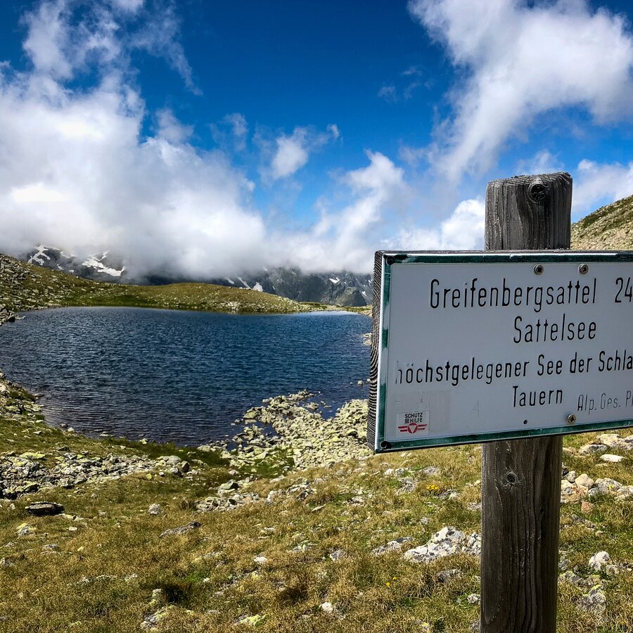
Am Greifenbergsattel | © Steiermark Tourismus | Martina Traisch
4/8
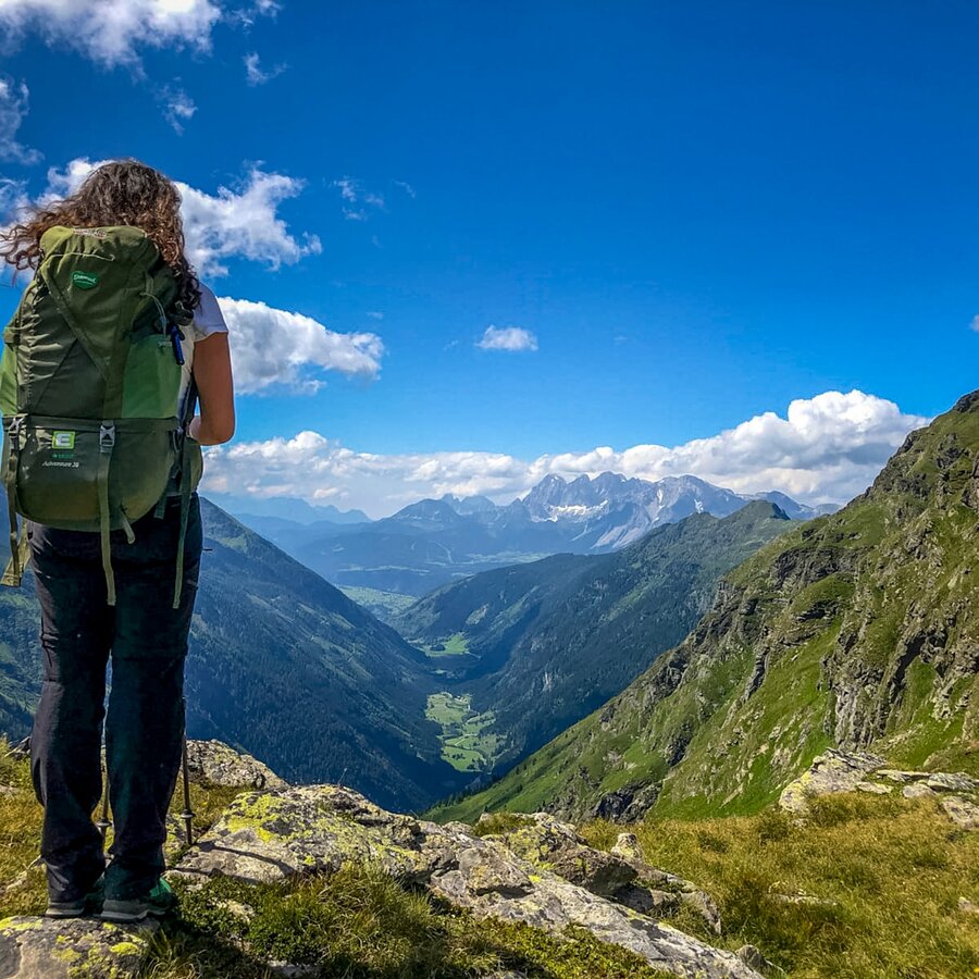
Blick Richtung Ennstal | © Steiermark Tourismus | Martina Traisch
5/8
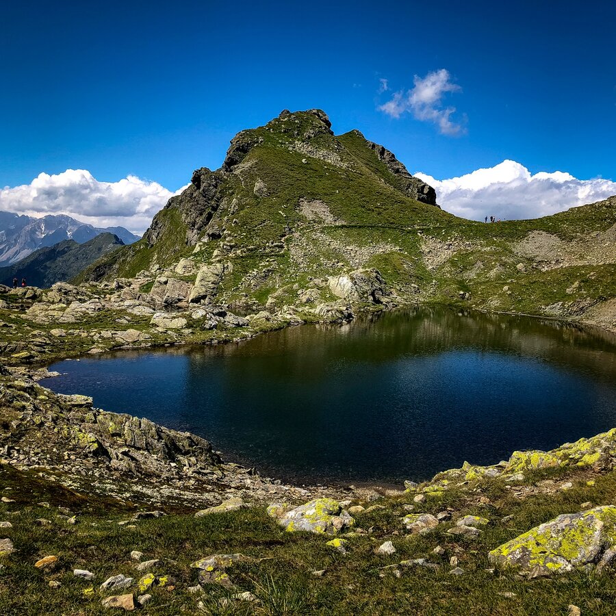
Seenlandschaft in den Schladminger Tauern | © Steiermark Tourismus | Martina Traisch
6/8
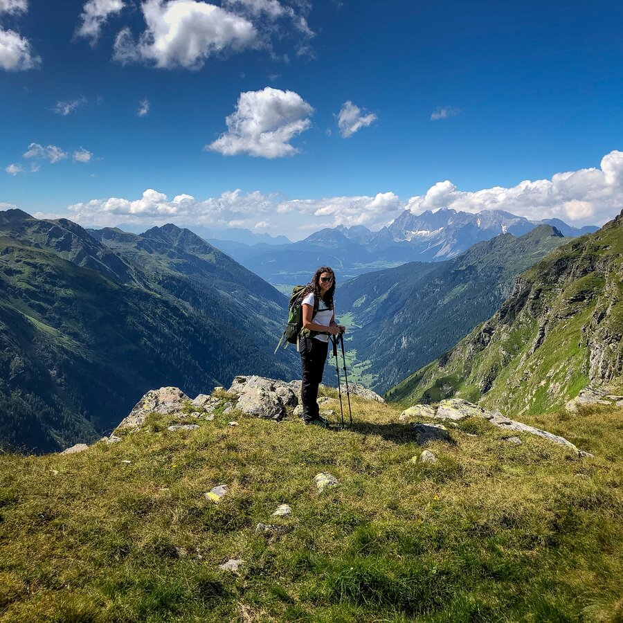
Pause zwischendurch | © Steiermark Tourismus | Martina Traisch
7/8
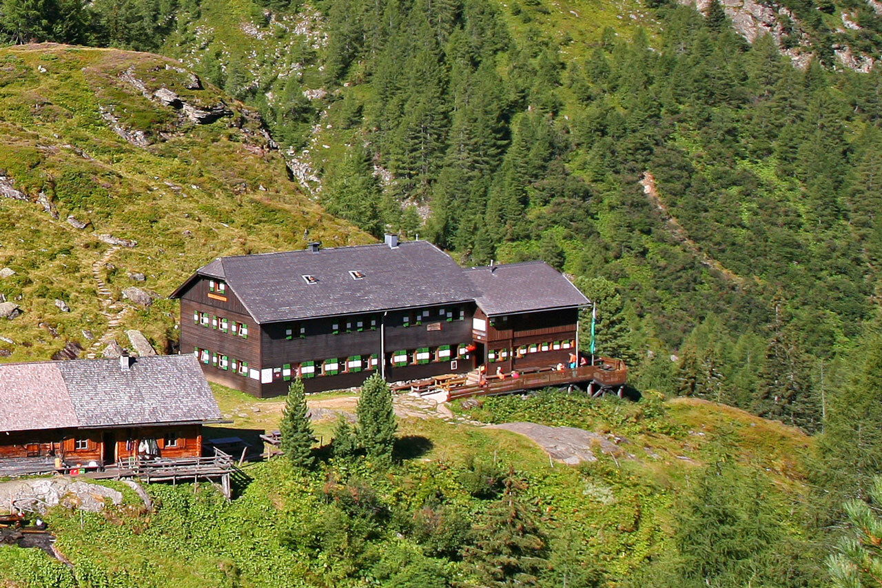
Preintalerhütte, Schladminger Tauern | © TVB Schladming-Dachstein | Herbert Raffalt
8/8

What the weather will be like Schladming (740m)
Today, 11.10.2026
Mostly cloudy with occasional sunny spells. Light rain will start in the afternoon.Morning

7°C
sr.Regenwahrscheinlichkeit
50%
sr.Windstärke
5 km/h
Noon
13°C
sr.Regenwahrscheinlichkeit
45%
sr.Windstärke
5 km/h
Night

10°C
sr.Regenwahrscheinlichkeit
60%
sr.Windstärke
5 km/h
Tomorrow, 12.10.2026
Rather cloudy in the morning, then sunny spells will develop gradually.Morning
5°C
sr.Regenwahrscheinlichkeit
20%
sr.Windstärke
0 km/h
Noon

12°C
sr.Regenwahrscheinlichkeit
30%
sr.Windstärke
5 km/h
Night

7°C
sr.Regenwahrscheinlichkeit
5%
sr.Windstärke
5 km/h
Forecast
13.10.2026

1°C
14°C
14.10.2026
2°C
14°C
15.10.2026
4°C
16°C
