Backbone (Rückgrat) entire length / Feldbach-Klöch
Characteristics
Best season
The tour in numbers
Map & downloads
More information
We circumvent the quarry and hike halfway up the Bschaidkogel, from where we continue to the Mühlsteinbruch. With a bit of luck, we may even find fossils that were washed up here about 10 million years ago by what was then known as the "Mur"! And those who cannot find anything, may still appreciate the view from the lookout post.
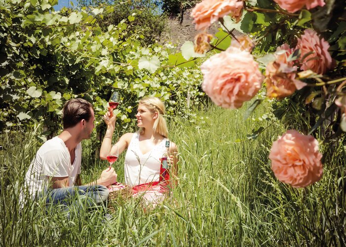
Along the forest path we then descend to Bad Gleichenberg, the heart, where natural healing waters for cardiovascular problems spring to the surface. Walking through the center of the village, we will arrive at the well-known Kurpark. The hike leads to the east.Bad Gleichenberg - St. Anna am Aigen. Across basalt to the vineyardsThe second stage of the hike on the Rückgrat leads from Bad Gleichenberg up the fascinating Stradner Kogel and further on to the picturesquely situated St. Anna am Aigen, which we approach from its most scenic side. From the train station we walk only a short distance to the park, where we soon come across the yellow signs for the Rückgrat. We leave Bad Gleichenberg towards the South, cross the main road, ascend the Steinbach and walk further up through the forest to the Stradner Kogel, at 609 m the highest elevation in the Vulkanland. Instead of a panoramic view from the summit, we are surprised by the extensive basalt plateau of Hochstraden. Two million years ago, it was formed by thin lava that flowed out through a vent and spread over the boulders below. There it solidified to become a “basalt cover”. From there we cross the plateau to reach the Waltra rock, where we can see the beginning crumbling rim of this "cover". This mystical location is an ancient worship place, which is also evidenced by artefacts discovered in the area. Take your time to let this place sink in - it's worth it! We continue through the forest to Schemming, where a beautiful view of St. Anna opens up next to the chapel. The trail now descends steeply through beautiful vineyards into the Pleschbach valley, crosses the stream and, on the other side, continues diagonally uphill through the forest. Continuing past the tennis court, we climb steeply up to the town, which rises imposingly on a rock. As a special gem, the well-known wine village is home to the Vinothek Styria, where one may taste wines from all over Styria.St. Anna am Aigen – Tieschen. Through volcano and wine.This route starts rather unusual, from the panoramic terrace with a view of Slovenia, down the stairs to the wine store and across the lower terrace to a meadow. Further on we pass below the church, cross the road and go down the steep slope. Over the Pleschbach and further over meadows and fields we finally find a curiosity in Klapping: Carbon dioxide leaking from the ground keeps the "Brodelsulz" bubbling! The gas is created from organic material buried deep under lava and ash, which is slowly transformed into turf and coal. Through the forest and past an accessible mineral water well, we arrive at a well-designed rest area with a fountain in Frutten. For a short distance, the road takes us through the village, before we ascend through the vineyards and a forest section to the Vulkanland lookout post. From here we enjoy an impressive panoramic view of the Styrian peripheral mountains as far as Slovenia and Carinthia. We continue along the "dragons back" to the Rosenberg, which is one of Vulkanland’s most beautiful spots. Soak up the vitality that flows into the surrounding landscape! We gently descend downhill through the vineyards along the edge of a natural amphitheater until we leave the ridge at the road between Hof and Frutten in the direction of Größing. Passing the graceful Größinger Tanner, where we can still see some tumuli from the 1st and 2nd century A.D., and crossing the Drauchenbach stream, we finally arrive in Tieschen.
With the BusBahnBim app from Verbundlinie, timetable information has never been easier: all bus, train and streetcar connections in Austria can be queried by entering locations and/or addresses, stops or important points. The app is available as a free app for smartphones (Android, iOS) - on Google Play and in the App Store.
Hauptstraße 2a
A-8280 Fürstenfeld
Phone: +43 3382 55100
info@thermen-vulkanland.at
www.thermen-vulkanland.at
Steirisches Vulkanland
Gniebing 148
A-8330 Feldbach
Phone: +43 3152 8380-12
www.vulkanland.at
Gallery


What the weather will be like
Feldbach (283m)