
Stage 08 From Glacier to Wine South Route Putzentalalm - Krakau
Characteristics
Best season
The tour in numbers
Map & downloads
More information
Detaillierte Informationen zur Anreise finde Sie hier.
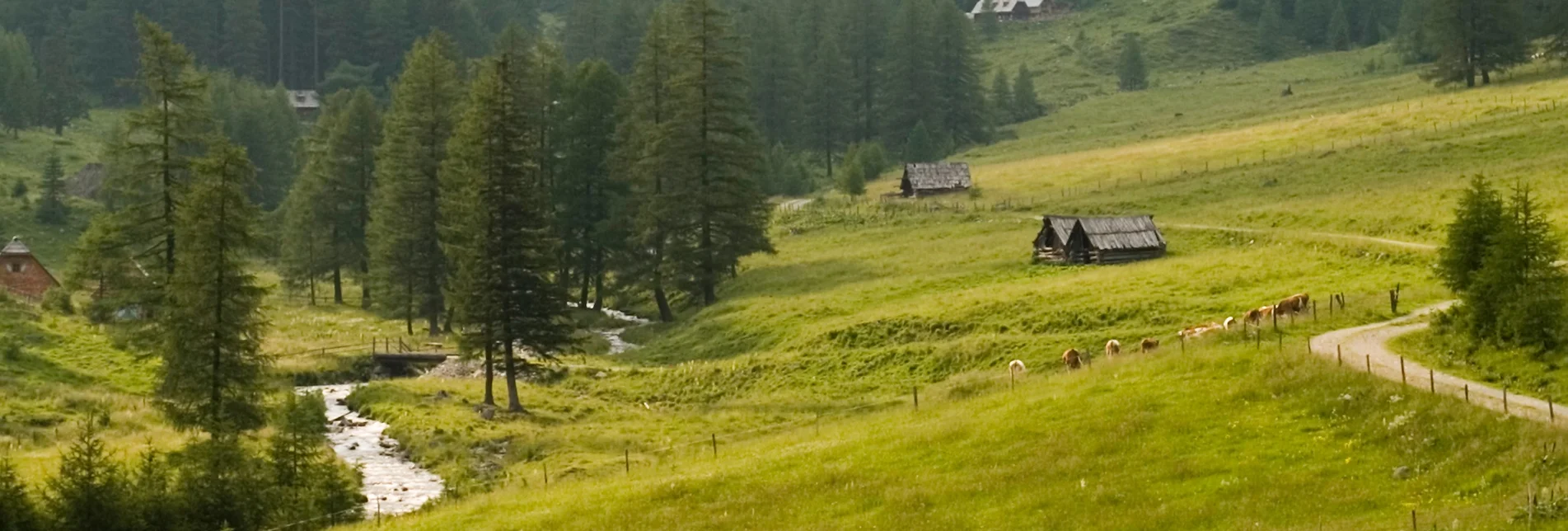
From the Putzentalalm (Tel. +43 664 9262200) the path leads us right from the start uphill towards Prebertörl, the highest point of this stage of the hiking route "From glacier to wine". Passing a hunting lodge, the path climbs steadily and becomes steeper as well as more challenging, because some scree slopes have to be mastered as well as the serpentine path that takes us to the Prebertörl with its 2,194 meters. The beautiful view back to the north into the Putzental valley in the Sölktäler Nature Park with the romantically situated Schwarzensee lake and to the south into the Prebertal valley with its abundance of water are, however, the reward for the challenging meters of altitude that we have covered in the last few hours.
From now on, we head steadily downhill through the Prebertal valley with its enchanting alpine meadows, past small waterfalls and mountain lakes, first to the Möslhütte (Tel. +43 664 9632670). Lisi Kleinferchner still manages her alp on the Möslalm at 1,600 m above sea level in the traditional way. Dairy cows, young cattle, goats and pigs truly spend a wonderful summer here in the Prebertal. Among their specialties are the many different types of cheese that they produce.
Afterwards we continue out of the valley, where we reach the Ebenhandlhütte (Tel. +43 664 6458353). This is also a good place to stop for a rest, as we still have about 5 km to go to Krakauhintermühlen, our stage destination. Via the Klausnerbergsäge we finally reach the small village Krakauhintermühlen, which is the western end of the Krakau. The two other villages on the plateau are Krakauschatten and Krakaudorf, which offer equally beautiful accommodations to recover us for the next day for the stage to St. Peter am Kammersberg in the best possible way.
Detailed information about arriving by ÖBB (Austrian Federal Railways) can be found at www.oebb.at or on the Verbundlinie Steiermark website www.busbahnbim.at
With Verbundlinie’s BusBahnBim route planner app, planning your journey has never been easier: simply enter towns and/or addresses, stop names or points of interest to check all bus, train and tram connections in Austria. The app is available free of charge for smartphones – on Google Play and in the App Store
Steiermark Tourismus
Tel. +43 316 4003
If you would like to hire a tour operator, simply book with Steiermark Touristik, the official travel agency of Steiermark Tourismus:
Tel. +43 316 4003 450,
The Steiermark Touren app, available free of charge on Google Play and the App Store (Android, iOS), offers detailed first-hand information: brief facts (length, duration, difficulty, ascent and descent/elevation gain, ratings), map, route descriptions, altimeter, compass, peak finder, navigation along the tour. You can also create your own personal lists of favourite tours and sites, store tours and destinations offline, use social media channels, and much more.
Gratis Pocket Card Wanderroute "Vom Gletscher zum Wein" finden Sie auf www.steiermark.com
Kompass WK293 Dachsteingruppe, Schladminger Tauern www.kompass.at
Freytag & Berndt WK 201 Schladminger Tauern · Radstadt · Dachstein www.freytagberndt.at
Rother Wanderführer "Vom Gletscher zum Wein": auf 160 Seiten mit 80 Farbabbildungen 60 Höhenprofile, 60 Wanderkärtchen im Maßstab 1:75.000, zwei Übersichtskarten, GPS-Tracks zum Download, Format 11,5 x 16,5 cm, kartoniert mit Polytex-Laminierung, ISBN 978-3-7633-4550-2, www.rother.de


