
Hartelsgraben
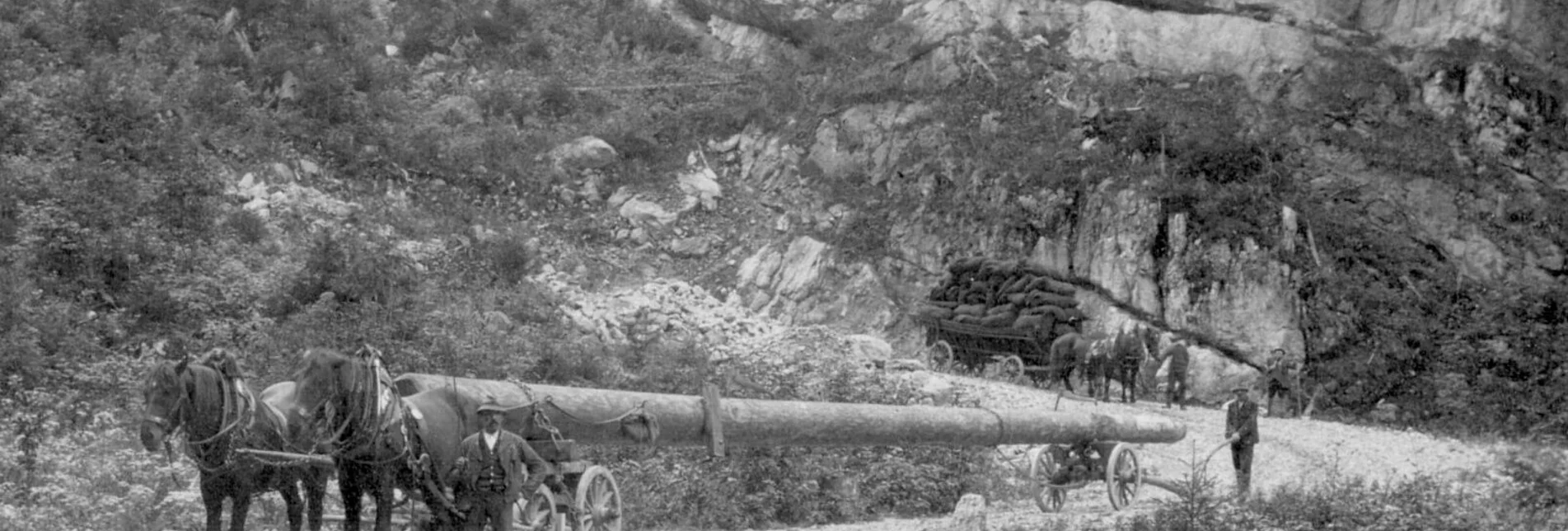
"The Hartelsgraben is considered a natural jewel because of its imposing rock and water scenery and the gorge forest. It has been used for economic purposes over a long period of time: for 500 years, a historic cabbage transport road has led from Johnsbach to Hieflau. In 1892, the Styrian Provincial Forests built a logging road down to the Enns - the first mountain forest road in the Monarchy and much visited. Particularly admirable are the dry stone sluices built by experts from Friuli. They have withstood all avalanches for 130 years."
The trail leads through the Hartelsgraben on trail no. 665 via the oldest forest road in Styria! The cool, moist air in the gorge forest is a welcome refreshment on warm summer days. The gorge forest you hike through is a special feature, as it is one of the few hardwood-dominated forest types in the area. The history of the old forest road and the former intensive charcoal smelting is vividly told along the theme trail in the Hartelsgraben.
Characteristics
Best season
January
February
March
April
May
June
July
August
September
October
November
December
The tour in numbers
medium
Level of difficulty
6,3 km
Route
2:46 h
Time
580 hm
Uphill
581 hm
Downhill
1101 m
Highest point
Map & downloads
More information
from Hieflau or Admont on the B 146 Gesäusestraße to Hartelsgraben car park
The starting point is the Hartelsgraben car park on the B146 Gesäusestraße. Follow the wildly romantic stream through a gorge-like ravine, surrounded by small and larger waterfalls, for about 1 1/2 hours to the Hartelsgraben hut. The Hartelsgraben is currently being equipped by the Styrian Provincial Forests with themed panels and a show charcoal kiln to tell the story of wood processing in this impassable terrain.
After a long ascent along the old forest road, you reach the first pastures of the Sulzkaralm via trail 601. This pasture impresses with its outstanding alpine landscape. Large spruce trees, boulders in the middle of the alpine pastures, small moors with cotton grass and a small lake - the Sulzarsee - are not only habitats for numerous animals and plants, but also delight the hiker's eye. Here it is easy to observe marmots or chamois on the steep slopes surrounding the alp. Cows and horses graze on the alpine pastures, the small alpine hut invites you to take a short rest and refreshment at the fountain.
Öffentliche Verkehrsmittel
Buslinie 912 Weißenbach/St.Gallen - Liezen (www.busbahnbim.at )
Hartelsgraben car park
Tourismusverband Gesäuse
Hauptstraße 35, 8911 Admont, Österreich
Tel. +43 (0) 3613 21160 10
Email: info@gesaeuse.at
www.gesaeuse.at
Carto.at / Wander-, Rad- & Schitourenkarte „Nationalpark Gesäuse“Gesäuseberge – Haller Mauern – Eisenerzer Alpen West, Nr. 801M 1: 35.000 http://www.carto.at/gesaeuse/
Kompass/ Wander-, Fahrrad- & Schitourenkarte „Nationalpark Gesäuse“, Nr. 206
M 1 : 25.000 http://www.kompass.de/touren-und-regionen/wanderkarte/dest/100148-alpenregion-nationalpark-gesaeuse/
Alpenvereinskarte „Gesäuse und Ennstaler Alpen“, Blatt 16, M 1 : 25.000
http://www.freytagberndt.com/shop/9783928777346-alpenvereinskarte-16-ennstaler-alpen-gesaeuse/
Gesäuse


